High Definition (HD) Map is a map with precise definition of road lanes with rich semantics of the traffic rules. High-Definition Map or HD map is essential for autonomous driving, as it enables the vehicle to perceive its surroundings, plan its route, and execute its maneuvers safely and efficiently. ZENRIN contributes to the future mobility society by providing optimized and highly accurate HD map of Japan in compliance with local rules of the road and supporting safe autonomous driving. Self-driving cars require HD maps to localize themselves precisely and to navigate accurately on a lane-level basis.
ZENRIN develops efficient data maintenance system based on AI to expand the HD map coverage for general roads. The HD map of the company enables accurate vehicle positioning, supports sensor recognition, and anticipates lane guidance for Autonomous driving. World´s first certified Level 3 autonomous car was using ZENRIN´s HD map for autonomous driving. Currently ZENRIN´s HD map also in combination with SD map is utilized by some Japanese OEMs for autonomous driving on Highway.
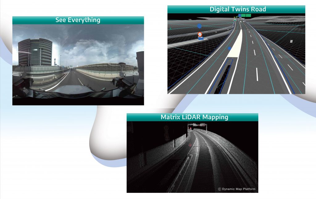
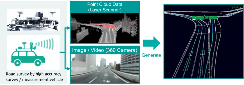
Accurate data collection
Created from data collected using high accuracy survey vehicle, HD map is deigned to support ASAD and autonomous vehicles by providing essential data for real-time decision making such as allowing the vehicle to recognize its surroundings and determine how to proceed.
Accurate Positioning
Geographical object captured by the sensor are matched with ZENRIN map data to accurately determine the vehicle’s position for providing accurate route guidance.
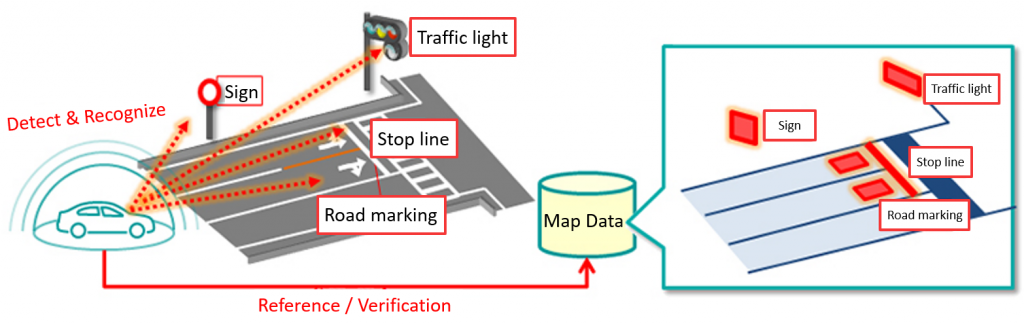
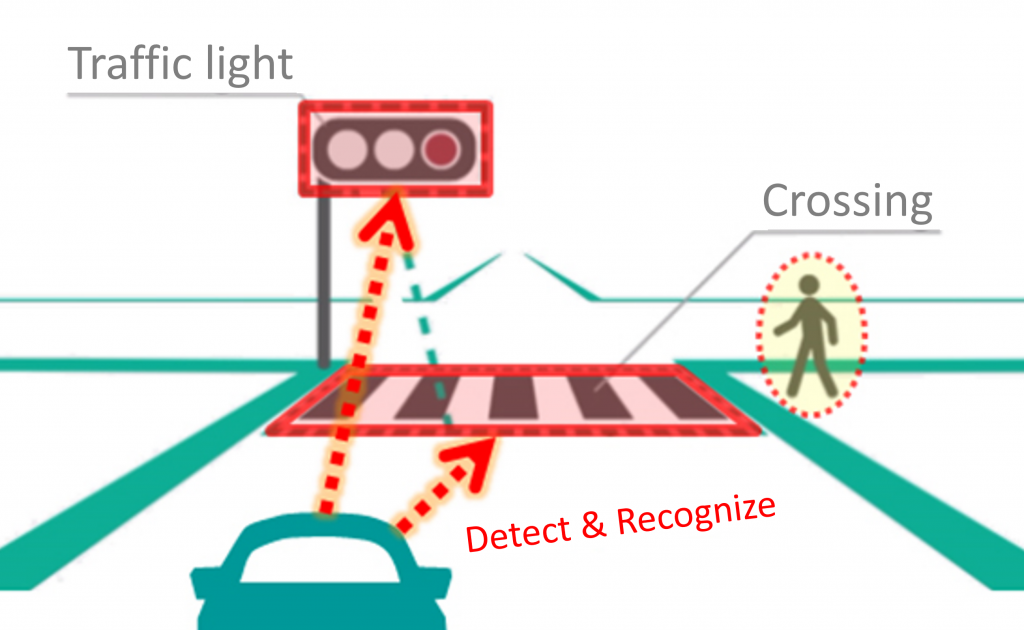
Surrounding Environment Recognition
Vehicles can refer to ZENRIN map data in advance for signs, pedestrian crossings, and other geographical objects to be capture by the sensor, enabling more accurate recognition of the environment.
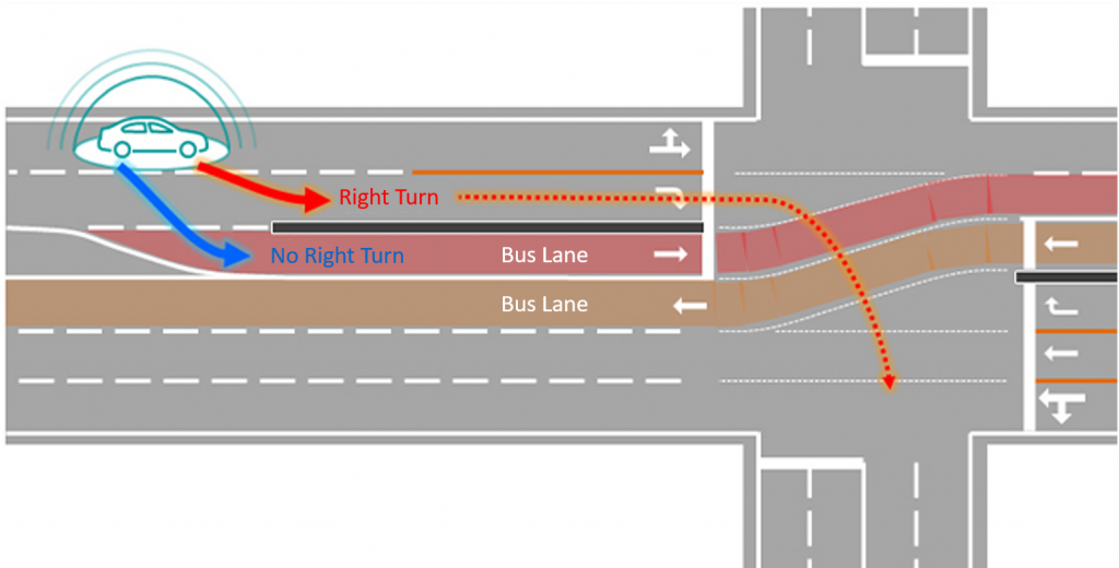
Even on complex roads, vehicles can refer to ZENRIN map data for lane and road regulation information in advance, enabling more accurate lane guidance.