ZENRIN supports Automotive industry by providing HD map, SD map or 3D Map with rich and fresh attributes including arrival point information, ADAS, visual contents, and much more.
Standard Definition Map (SD)
ZENRIN offers standard definition map (SD) that enables great driving experience by making the best use of our know-how in map development and maintenance we have been working on for many years.
With our ISA and ADAS attributes, ZENRIN is able to provide automotive solutions that support safe and secure driving. In addition, combining location information with our rich attributes we create a fresh and highly accurate map.
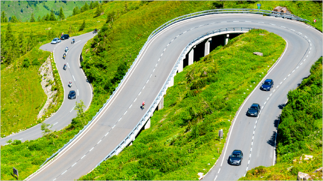
Autonomous driving requires not only information obtained from cameras and sensors, but also accurate map data that enables foreseeing.
ZENRIN´s HD map enables accurate vehicle positioning, supports sensor recognition, and anticipates lane guidance for Autonomous driving. Efficient data maintenance system based on AI to expand the HD map coverage for general roads. Besides ZENRIN´s HD map is already utilized by some Japanese OEMs for autonomous driving on Highway.
Discover more about our HD map for automotive solutions.
EV Solutions
As respond to the increased environmental concerns, the automotive industry worldwide is switching to eco-friendly electric vehicles (EVs).
ZENRIN offers automotive solutions and serivces for EV drivers based on our map data and know-how accumulated over the years. We are able to provide the best route guidance including EV charging stations and their attributes, such as charging type (quick/normal), connector type, voltage, arrival point, etc. Moreover, our EV Route Planner System calculates the optimal route considering the fuel consumption based on the road elevation and gradient information and EV charging station with additional attributes like connector type, charging speed, occupancy, etc.
ZENRIN field survey
Our way of data collection for city map and navigation use enable us to obtain detailed information on Door to Door arrival point, EV charging stations, etc. In addition, by using of dedicated measuring vehicles we are able to obtain various data on traffic regulations, road width and local conditions by actual driving.
About 1000 survey staff
With about 70 survey bases reached
City Map coverage 100%
Zenrin’s high-precision spatial data is one of the key components of dynamic maps. It supports two steps in the automated driving/ADAS system: “recognition” of where the car is and what is on the road surface, and ” decision-making” of where to go and how to navigate.