The use of drones is steadily expanding in various industrial fields, such as logistics, infrastructure management, agriculture, and disaster response. Consequently, ZENRIN is providing airspace information solutions to help achieve safe and secure drone flights.
Drones - the future solution of many industries
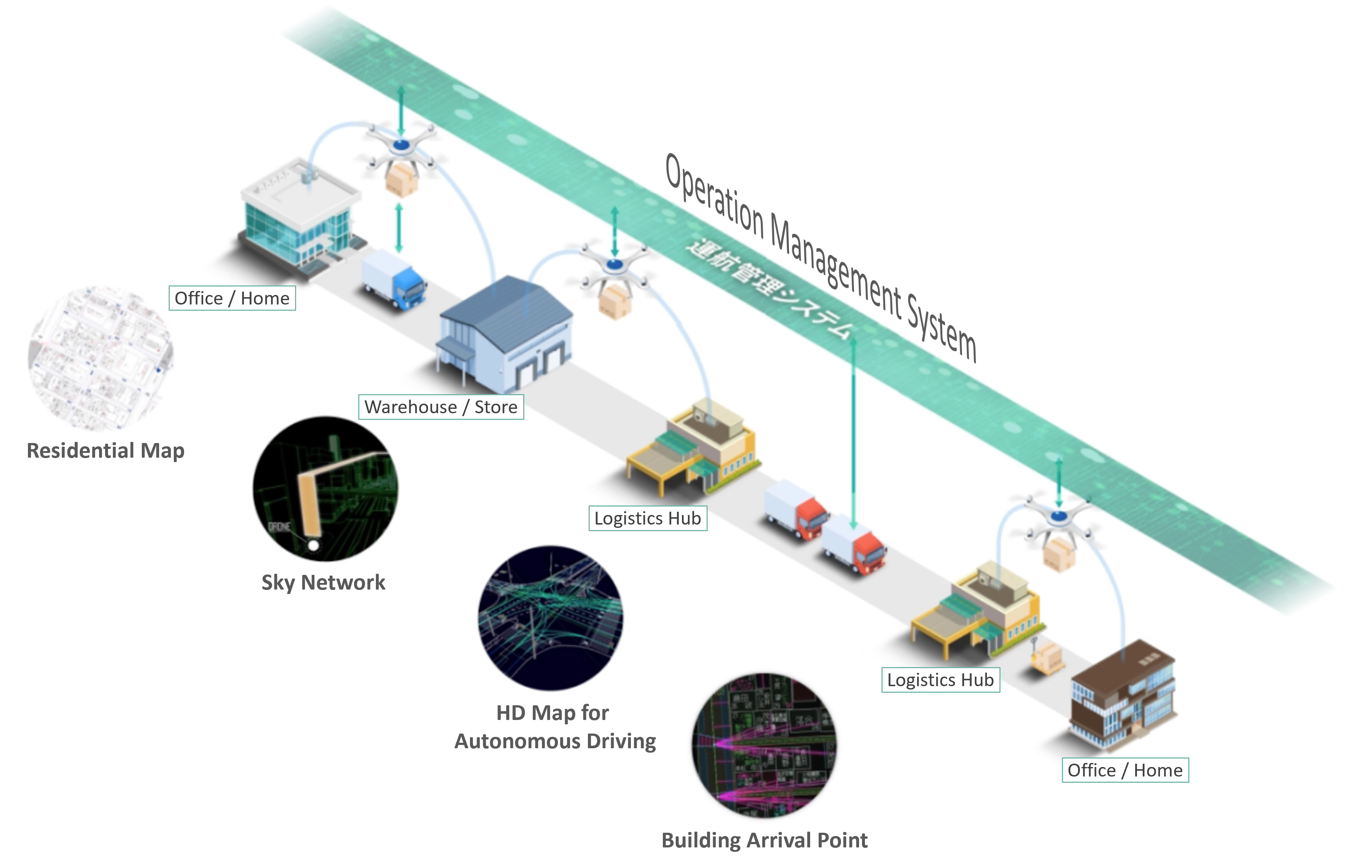
ZENRIN Mobility Support Platform
Helping to achieve advanced logistics services that seamlessly connect different modes of transportation from land to air
ZENRIN Initiative
ZENRIN propose the following 2 solutions to tackle the challenges of drone collision due to uncontrolled airspace
Sky Network
Define optimal sky network by analyzing 3D spaces
Utilize airspace above rivers as the main route for drone in logistics
Calculate route based on ZENRIN’s detailed map data to avoid buildings, airspace above roads, obstacles, etc
In addition, the sky network ensure safety by taking into account dynamic information such as weather conditions
Airspace Management
Support safe airspace management by eliminating conflicts between drones, obstacles, and manned aircraft
Data Collection Weather information, communication quality information, and location information of manned aircraft are collected using cloud
Data Consolidation Variety of information collected are structured and consolidated into four layers based on ZENRIN’s location information
Japan has been at the forefront of using drones for last-mile delivery. Utilizing ZENRIN´s data several companies and organizations in Japan are actively providing with drone delivery services to improve efficiency and speed in delivering packages.
These initiatives in Japan highlight the potential of drones to overcome geographical challenges and improve the efficiency of last-mile delivery, particularly in areas with difficult terrain or limited transportation infrastructure.