GIS stands for Geographic Information System. It is a powerful technology that combines geographic data (information about locations on the Earth’s surface) with attributes (additional information) to analyze, visualize, and interpret patterns and relationships within spatial data. GIS enables users to capture, store, manipulate, analyze, and present geographic information.
GIS allows you to overlay different layers of data, such as land use, population density, infrastructure, environmental factors, and more, to gain valuable insights into the relationships between geographical features and various phenomena. By combining a wide range of GIS content and various applications with map data as the foundation of, ZENRIN offers various solutions in order to meet the diverse needs related to GIS.
Below are some of ZENRIN’s GIS contents.
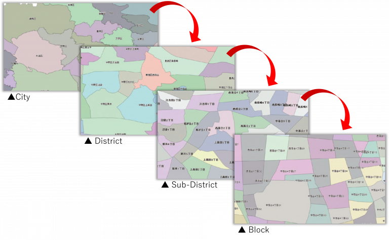
Administrative Boundary Polygon Data
This comprehensive database is available in 4 levels, encompassing a total of approximately 377,000 polygons for cities, districts, sub-districts, and blocks in Japan. It surpasses the level of detail provided by the national census (approximately 220,000 polygons), enabling users to conduct precise area analysis with exceptional accuracy.
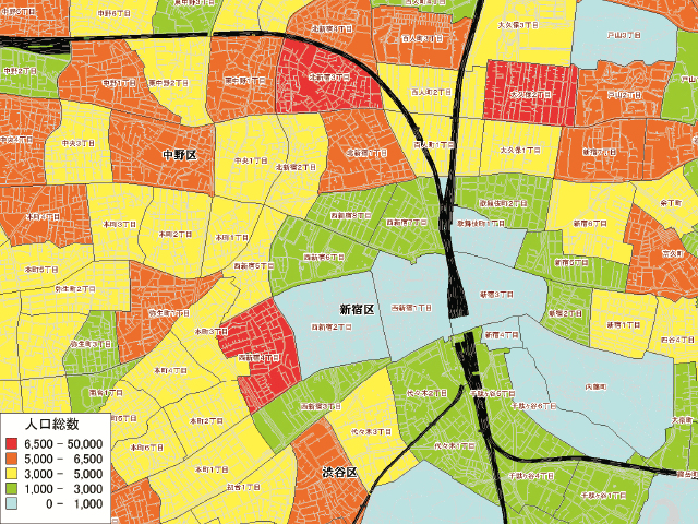
Statistical Map Data
By integrating Administrative Boundary Polygon Data with data from national census and basic resident registry, Statistical Map Data, such as demographic or incom erelated data empower users to effectively conduct area-specific marketing with high precision.
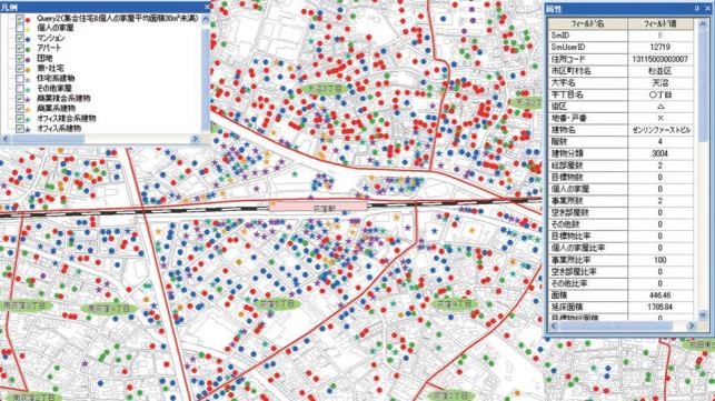
Building Point Data
Derived from the ZENRIN Residential Map Database, the Building Point Data encompasses details on approximately 38 million buildings and houses in Japan. In addition to address, latitude, and longitude information, it provides comprehensive data such as building names, number of floors, building classification, number of units within apartment buildings, and number of stores within commercial buildings.